Skip to content
Menu

Country · 10 sites · 2 hubs

Roman Slovenia

Present-day Slovenia was inhabited by Illyrian and Celtic tribes until the Romans conquered the region in the 1st century BC. Under Roman rule the territory was divided three ways: part of it belonged to Venetia et Histria, the tenth region of Roman Italy in the classification of Augustus, and the rest to the imperial provinces of Pannonia and Noricum. The Romans established their main urban centres at Emona (Ljubljana), Poetovio (Ptuj) and Celeia (Celje). Emona was an Italian town rather than a provincial one, a point settled only in 2001 by a boundary stone found in the bed of the Ljubljanica river.

The main route from the Pannonian plain into Italy ran through here, and the Romans built military and trade roads to carry it. Mostly from the late 3rd century onward they also fortified it. The Claustra Alpium Iuliarum, a chain of interconnected walls and forts rather than a single rampart, closed the passes between Italy and Pannonia around the Postojna Gate. Its centre was Castra ad Fluvium Frigidum at Ajdovščina, and the hill fort of Ad Pirum on the Hrušica plateau was one of its principal fortresses. In 394 the Battle of the Frigidus was fought in the Vipava valley below.

As the western empire weakened through the 5th and 6th centuries the area suffered repeated invasions, and Alpine Slavs settled it in the late 6th century. Roman life ended; Roman stone did not. It survives as town walls in a city park, as marble tombs re-erected beside a village church, and as fort walls on a mountain pass. This page lists what we have visited and documented so far, from the well known to the almost forgotten.
Sources: Wikipedia (en) — History of Slovenia; Wikipedia (en) — Claustra Alpium Iuliarum; Wikipedia (en) — Emona

Roman towns

Several sites in one town: see them in a day on foot.

Hidden gems

Hidden gem

Remains that most visitors to the region never see.

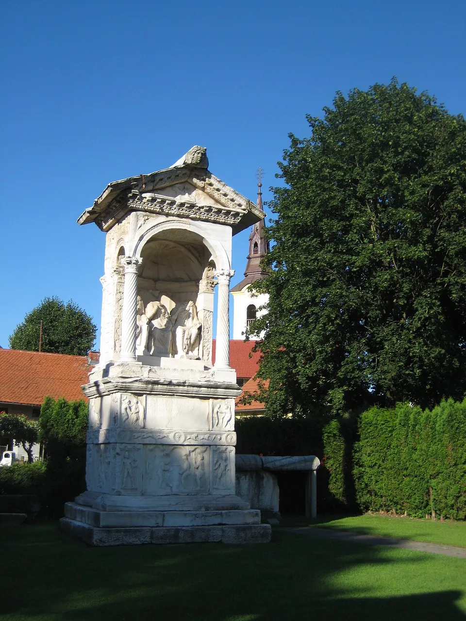
  1. A tall white marble tomb against a blue sky, a pedimented roof on twisted columns sheltering carved figures, standing on a high base whose sides are covered in relief panels.

    Photo: Sl-Ziga · Public domain · Commons

    necropolis · Žalec

    1. Šempeter Roman Necropolis

    An open-air archaeological park, hedged round, south-west of the church of St Peter.

    1st – 3rd c. ADTicketed
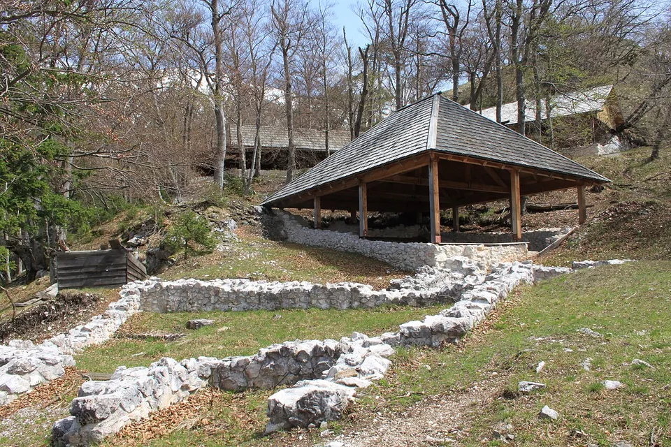
  2. Low drystone wall footings laid out across a clearing in bare woodland, with a large open-sided pavilion roofed in wooden shingles covering further remains behind them.

    Photo: JakobZ · CC BY-SA 3.0 · Commons

    fort · Žirovnica

    2. Ajdna

    The settlement was built on terraces just below the summit (the register says three; sl.wikipedia two, joined by a ridge).

    4th – 6th c. ADFree
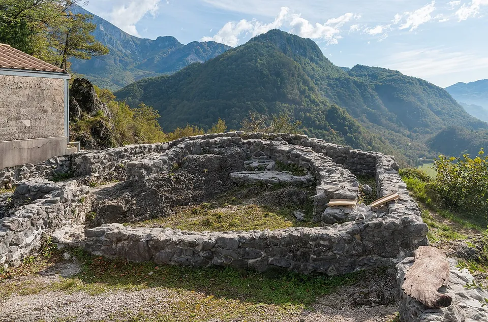
  3. The rebuilt stone footings of a small building with a rounded end, knee to waist high, on a rocky hilltop, with steep forested mountains rising behind under a blue sky.

    Photo: Krzysztof Golik · CC BY-SA 4.0 · Commons

    fort · Kobarid

    3. Tonovcov grad

    The settlement of the second half of the 5th and the 6th centuries was about 150 m long and 90 to 120 m wide — published figures differ (sl.wikipedia; the Tolmin museum) — inside a double defensive wall, with many stone houses and four early Christian churches (the Tolmin museum).

    3rd – 6th c. ADFree
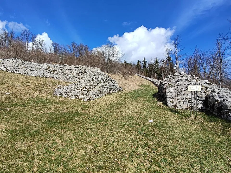
  4. Two banks of piled pale limestone rubble, waist to head high, ending either side of a grassy gap, with a small information sign on a post and bare trees behind.

    Photo: Ajznponar · CC0 · Commons

    fort · Ajdovščina

    4. Ad Pirum

    The fort follows the ground in an irregular oval, 250 m long and up to 75 m wide.

    1st c. BC – 5th c. ADFree
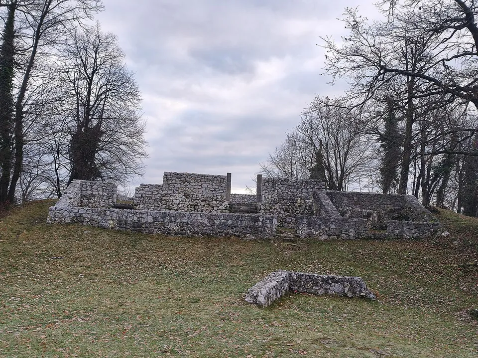
  5. Grey drystone walls standing about head height on a grassy clearing among bare trees, with lower foundation courses running away from them across the slope.

    Photo: Ajznponar · CC BY 4.0 · Commons

    fort · Šentjur

    5. Rifnik

    The plan of the settlement is the point.

    1st – 6th c. ADFree
Low drystone wall footings laid out across a clearing in bare woodland, with a large open-sided pavilion roofed in wooden shingles covering further remains behind them.

Photo: JakobZ · CC BY-SA 3.0 · Commons

fort · Žirovnica

Ajdna

The settlement was built on terraces just below the summit (the register says three; sl.wikipedia two, joined by a ridge).

Hidden gem
Open page →
The rebuilt stone footings of a small building with a rounded end, knee to waist high, on a rocky hilltop, with steep forested mountains rising behind under a blue sky.

Photo: Krzysztof Golik · CC BY-SA 4.0 · Commons

fort · Kobarid

Tonovcov grad

The settlement of the second half of the 5th and the 6th centuries was about 150 m long and 90 to 120 m wide — published figures differ (sl.wikipedia; the Tolmin museum) — inside a double defensive wall, with many stone houses and four early Christian churches (the Tolmin museum).

Hidden gem
Open page →
A tall white marble tomb against a blue sky, a pedimented roof on twisted columns sheltering carved figures, standing on a high base whose sides are covered in relief panels.

Photo: Sl-Ziga · Public domain · Commons

necropolis · Žalec

Šempeter Roman Necropolis

An open-air archaeological park, hedged round, south-west of the church of St Peter.

Hidden gem
Open page →
Grey drystone walls standing about head height on a grassy clearing among bare trees, with lower foundation courses running away from them across the slope.

Photo: Ajznponar · CC BY 4.0 · Commons

fort · Šentjur

Rifnik

The plan of the settlement is the point.

Hidden gem
Open page →
Two banks of piled pale limestone rubble, waist to head high, ending either side of a grassy gap, with a small information sign on a post and bare trees behind.

Photo: Ajznponar · CC0 · Commons

fort · Ajdovščina

Ad Pirum

The fort follows the ground in an irregular oval, 250 m long and up to 75 m wide.

Hidden gem
Open page →
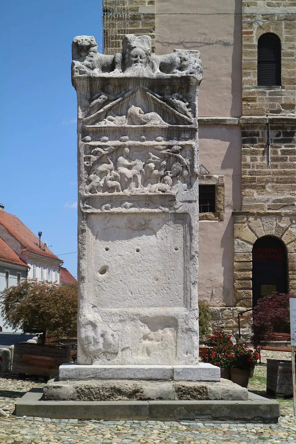
The same stele seen close and square on, its upper panels carved with figures and animals, the lower half plain stone pierced by several round holes, standing on a stepped stone base.

Photo: Clemens Stockner · CC BY-SA 4.0 · Commons

city · Ptuj

Poetovio – Ptuj

The Orpheus Monument stands on Slovenski trg in front of the Town Tower, where it has always stood: it is the oldest public monument in Slovenia still in its original place, and the largest known monument from the Roman province of Pannonia Superior (en.wikipedia).

Also here

  1. 1Mithraeum I of Ptuj
  2. 2Mithraeum III of Ptuj
Hub · 2 stops
Open page →
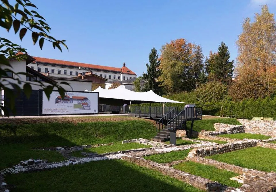
A sunken lawn crossed by low excavated stone walls, with a black metal viewing platform and steps, a white fabric canopy behind it, an illustrated information panel on the left and a large red-roofed building beyond the trees.

Photo: Matevž Paternoster, dokumentacija Muzeja in galerij mesta Ljubljane · CC BY-SA 3.0 · Commons

city · Ljubljana

Emona – Ljubljana

The best of it is in two small archaeological parks run by the city museum (MGML).

Also here

  1. 1Roman Walls in Mirje
Hub · 1 stop
Open page →

Numbers match the list. H marks a hub. Select a marker for a summary. Static map, generated at build time; the interactive map is one click away.