
.jpg)

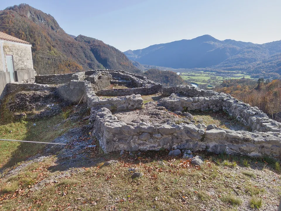
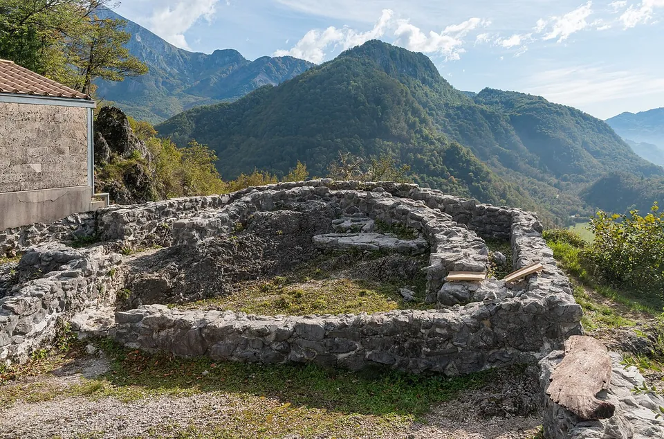
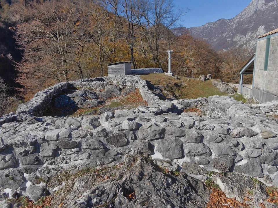
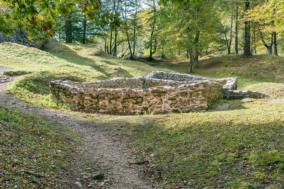
Tonovcov grad is a late antique fortified village on a rocky hill above the Soča, 2 km north of Kobarid, where the valley’s people took refuge and soldiers kept watch over the road into Italy. The low wall footings of its houses and early Christian churches line a path through the woods at the top.
What is there today
The settlement of the second half of the 5th and the 6th centuries was about 150 m long and 90 to 120 m wide — published figures differ (sl.wikipedia; the Tolmin museum) — inside a double defensive wall, with many stone houses and four early Christian churches (the Tolmin museum). The three that have been excavated had benches for the clergy and altars; the central church also had a baptistery, and the northern one an ambo, a raised reading desk. The defensive wall, 80 cm thick, can still be seen on the eastern side, where it cuts the settlement off from the lower ground; elsewhere it survives less well (sl.wikipedia). The Soča Valley tourist board describes the building remains as excellently preserved.
The hill also carries remains of both World Wars — steps and a bunker on the eastern slope, trenches and a cavern on top — which in places cut into the late antique layers; a German bunker was built right inside a late Roman cistern (sl.wikipedia).
Is it worth the trip?
If you are in the upper Soča valley, yes: it is free, a steep climb from the road, and it combines well-laid-out foundations of houses and churches with a view over the Soča. It is not a site of standing buildings — everything is at footing height — and it takes some effort to reach, so it is a walk with history in it rather than a monument you arrive at by car.
Getting there
There is a small car park about 2 km from Kobarid beside the road to Bovec. A small signpost on the left of the road points to the steep steps and the path up to the site (Soča Valley tourist board). There are no opening hours and no ticket: it is open woodland on a hilltop.
Visiting details
- Tickets
- Free
- Parking
- A small car park about 2 km from Kobarid beside the Kobarid–Bovec road; a small signpost on the left of the road points to the steps and the path (the tourist board).
Before you go
- The path starts with steep steps and climbs a steep, wooded hill; wear walking shoes.
- Remains from both World Wars — steps, trenches, a bunker built into a late Roman cistern — are on the hill too, and in places they have damaged the late antique layers.
History
The hill was used as early as the Stone Age and the Iron Age (sl.wikipedia). The first strong traces of Roman date are from the second half of the 3rd century AD, when people from the valley used it as a refuge; at the end of the 4th century and in the first half of the 5th a stronger military garrison held it (the Tolmin museum). German Wikipedia counts it, with the neighbouring hill of Gradič, among the most important strongpoints of the Claustra Alpium Iuliarum, the chain of defences that guarded the routes into Italy, here controlling the road over the Predil pass.
Its most important period was the last decade of the 5th century, when the Ostrogoths under Theodoric the Great ruled Italy (sl.wikipedia). The finds show a mainly native, Romanised population, with signs of Ostrogothic and Lombard garrisons from time to time. The post was abandoned at the end of the 6th century or somewhat later, and lived in again only briefly in the 9th century (the Tolmin museum). Trial excavations began in 1993, led by the Institute of Archaeology of the Slovenian Academy of Sciences and Arts (sl.wikipedia).
More photographs
.jpg)
Nearby
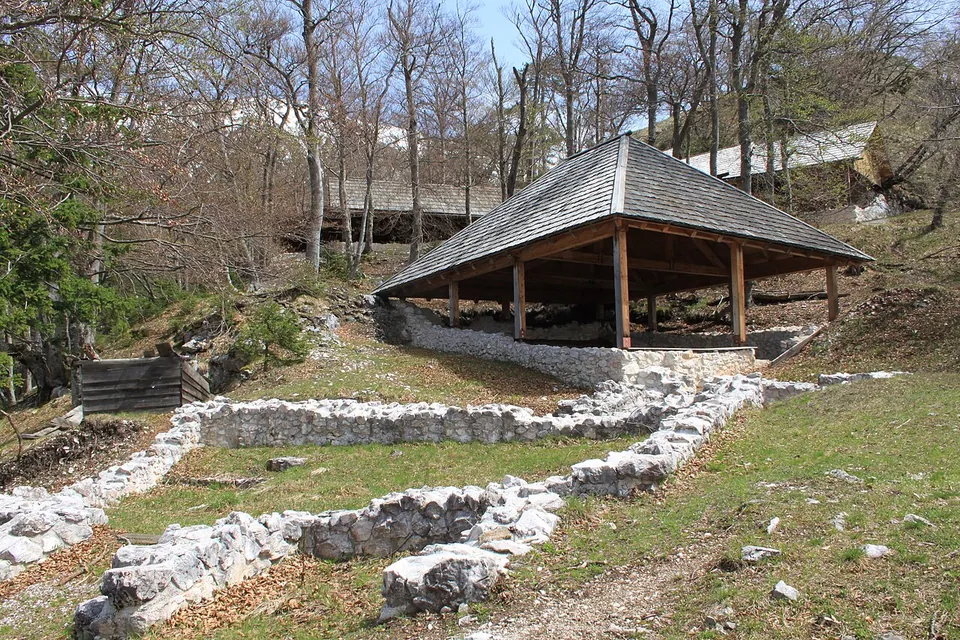
Photo: JakobZ · CC BY-SA 3.0 · Commons
46 km · fort · Žirovnica
Ajdna
The settlement was built on terraces just below the summit (the register says three; sl.wikipedia two, joined by a ridge).

Straight-line distances.
Sources
Every fact on this page comes from the records below, each used under the licence noted.
| Source | Licence |
|---|---|
| Wikidata Q1589025 | CC0 |
| OpenStreetMap way/993409559 | ODbL |
| Tolminski muzej — Tonovcov grad (the museum that excavated and presents the site) | licence not recorded |
| Soča Valley tourist board — Tonovcov Grad Hill (access) | licence not recorded |
| Register nepremične kulturne dediščine, unit 5022 (Ministrstvo za kulturo RS, CC BY 4.0) | licence not recorded |
| Wikipedia (sl) — Tonovcov grad | CC BY-SA 4.0 |
| Wikipedia (de) — Tonovcov grad | CC BY-SA 4.0 |