Skip to content
Menu
Hidden gemHub · 1stop2nd c. BC – 5th c. ADFree

Parentium – Poreč

Colonia Iulia Parentium, Parenzo

city · Istria County, Croatia

What it is
Poreč was the Roman colony of Parentium, a town built on a small peninsula on the west coast of Istria, and its old town still follows the Roman grid: the main streets are the ancient Decumanus and Cardo, and the remains of temples stand on Marafor, a Roman square.
What you’ll see
The town plan still shows the shape of the Roman castrum, and the two main streets, the Decumanus and the Cardo Maximus, keep their original lines.
Worth the trip?
For the basilica, yes. For Roman Parentium on its own, no: walking the Decumanus is a pleasure, and it is good to know you are on a Roman street, but the Roman remains amount to a few temple fragments.
Getting there & cost
The old town occupies the peninsula; everything is on foot. The nearest bus stop to the centre of the Roman town is about 230 m away (OpenStreetMap).FreeHours, tickets and parking
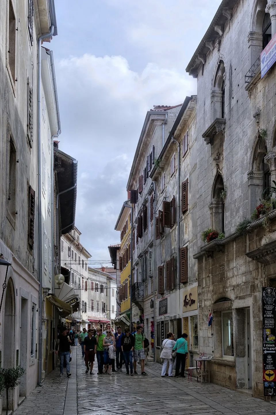
A narrow paved street between tall stone town houses with balconies and shop signs, busy with people, running straight into the distance under a cloudy sky.
The Decumanus, the main street of the Roman town, still following its original line. · Photo: Berthold Werner · CC BY-SA 3.0 · Wikimedia Commons
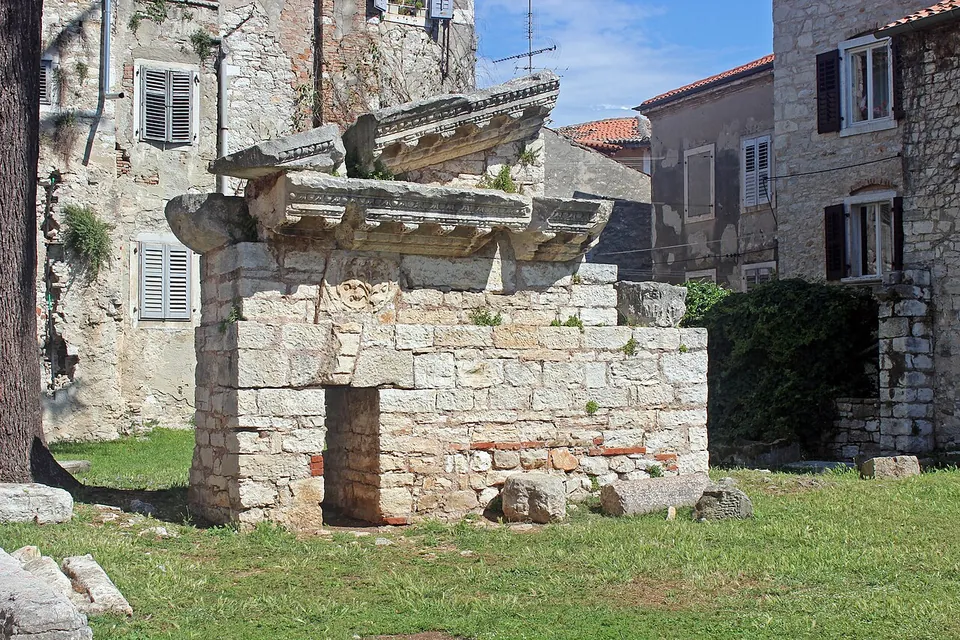
The ruined corner of a Roman temple built of large squared stone blocks, carrying fragments of a carved cornice, standing on a lawn among old stone houses.
Ruins of a Roman temple in the old town. · Photo: Maesi64 · CC0 · Wikimedia Commons
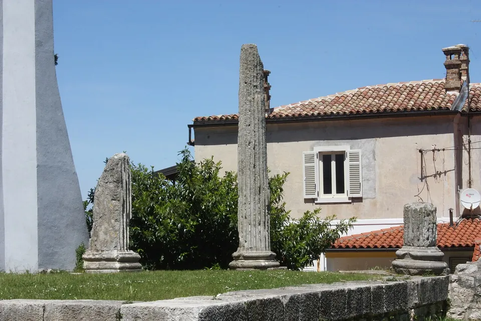
Two tall weathered stone column shafts and a short fragment standing on a grassy terrace in front of a house with shutters and a red-tiled roof.
Column fragments on the site the photographer identifies as the temple of Neptune. · Photo: Dguendel · CC BY 3.0 · Wikimedia Commons

Walking route

HParentium1
Schematic, generated at build time from each stop's coordinates; no streets are drawn. Some positions are approximate, so the route is a guide, not a path. Open on the interactive map →

Walk it in this order

About 200 m and 3 minutes on foot from the centre of Parentium, plus time at the stop.

  1. 1Ticketed

Walking times are estimates: the straight-line distance × 1.3 for streets, at 80 m a minute.

The stops

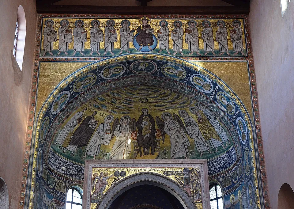
  1. The apse of a church covered in gold-ground mosaics, a row of standing apostles above an arch framed with round portrait medallions, and in the semi-dome below the Virgin enthroned with the Child between saints and angels.

    Photo: Carole Raddato · CC BY-SA 2.0 · Commons

    Stop 1 · site · Istria County

    Euphrasian Basilica

    The whole episcopal complex survives: the basilica itself, an atrium surrounded by porticoes with a collection of carved stones, an octagonal baptistery, the bishop's palace and a later bell tower (en.wikipedia).

Poreč was the Roman colony of Parentium, a town built on a small peninsula on the west coast of Istria, and its old town still follows the Roman grid: the main streets are the ancient Decumanus and Cardo, and the remains of temples stand on Marafor, a Roman square. Its great monument, though, is later — the 6th-century Euphrasian Basilica.

What is there today

The town plan still shows the shape of the Roman castrum, and the two main streets, the Decumanus and the Cardo Maximus, keep their original lines. Marafor is a Roman square with two temples attached to it; one, built in the 1st century AD and about 30 by 11 m, was dedicated to Neptune (en.wikipedia). What is visible today are fragments: column shafts and the ruined corner of a temple podium among the houses (the photographs).

The one stop with its own page is the Euphrasian Basilica, the 6th-century cathedral with its famous apse mosaics, whose predecessors began as a house church in the Roman town (the parish).

Is it worth the trip?

For the basilica, yes. For Roman Parentium on its own, no: walking the Decumanus is a pleasure, and it is good to know you are on a Roman street, but the Roman remains amount to a few temple fragments. Treat the Roman town as the setting for the basilica rather than a destination in itself.

Getting there

The old town occupies the peninsula; everything is on foot. The nearest bus stop to the centre of the Roman town is about 230 m away (OpenStreetMap). The temple remains on Marafor are in the open.

Visiting details

Tickets
Free
On foot
At the parking

Before you go

  • The Roman town is the street plan and a few temple ruins; the main monument, the Euphrasian Basilica, is 6th-century Byzantine and has its own page.

History

A Roman castrum was built in the 2nd century BC on the small peninsula, about 400 by 200 m, where the town centre now stands. Under Augustus the settlement became a town and part of the colony of Colonia Iulia Parentium (en.wikipedia); Pleiades records it becoming an oppidum of Roman citizens, then a municipium under Augustus, and a colony under Tiberius. A Christian community was organised here by the 3rd century, and its first bishop, Maurus, was martyred (the parish; en.wikipedia). After 476 the town was held by the Ostrogoths, and from 539 it belonged to the Byzantine Empire, under which the Euphrasian Basilica was built (en.wikipedia).
Nearby

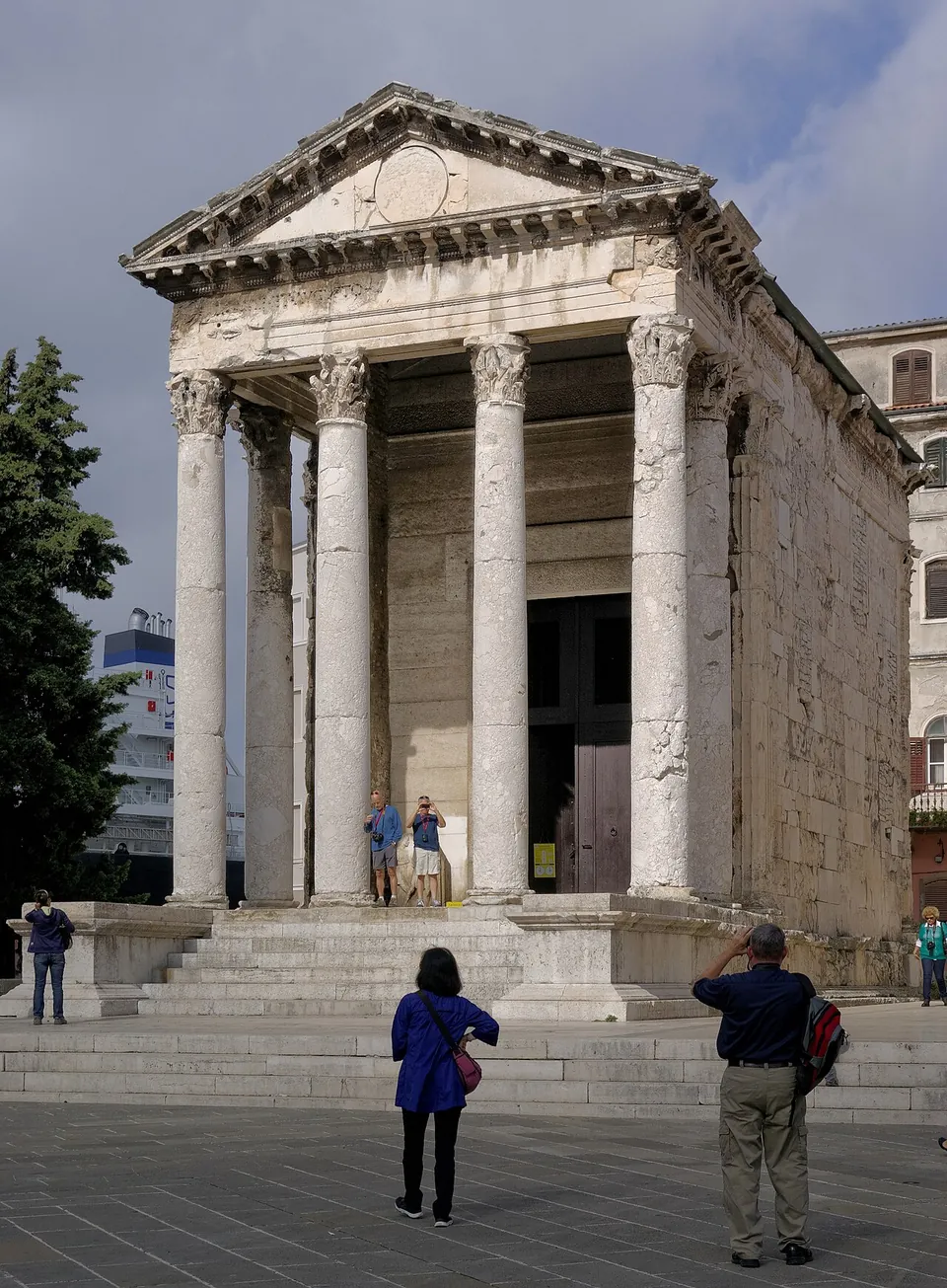
  • A small Roman temple on a high podium with a flight of steps, its porch of tall Corinthian columns carrying a carved frieze and a triangular pediment, with visitors standing on the square in front.

    Photo: Berthold Werner · CC BY-SA 3.0 · Commons

    44 km · temple · Istria County

    Temple of Augustus

    The temple is about 13 m high, 8.5 m wide and 17.65 m long: a closed shrine behind a porch of six Corinthian columns, four of them across the front.

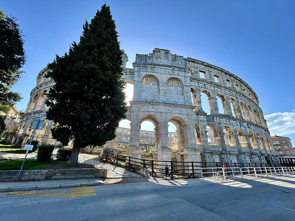
  • The pale limestone outer wall of the amphitheatre seen from the pavement, three storeys of arches and square windows rising against a blue sky, with a tall cypress in front.

    Photo: Olgierd Rudak · CC BY-SA 4.0 · Commons

    44 km · amphitheatre · Istria County

    Pula Arena

    The oval measures about 132 by 105 m, and the wall rises to 32.45 m at its highest (the operator; en.wikipedia).

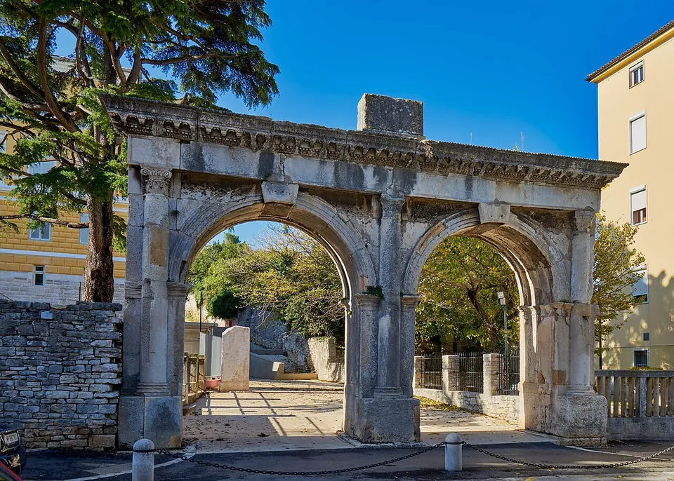
  • A Roman gateway with two equal round arches under one carved cornice, standing at the edge of a street with a stone wall on its left, trees behind and a paved path leading through.

    Photo: Georg Karl Ell · CC BY-SA 4.0 · Commons

    44 km · city · Istria County

    Pola – Pula

    The stops each have their own page: the Pula Arena, the amphitheatre; the Temple of Augustus on the forum; the Arch of the Sergii at the end of the main street; and the Small Roman Theatre on the slope of the central hill.

Straight-line distances.

Sources

Every fact on this page comes from the records below, each used under the licence noted.

SourceLicence
Pleiades 197427CC BY
Wikipedia (en) — PorečCC BY-SA 4.0
Župa Poreč — Eufrazijeva bazilika (the parish; the Roman and early Christian town)licence not recorded