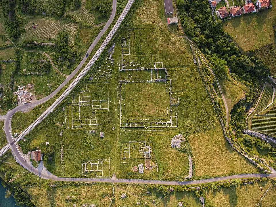
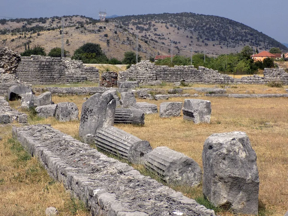
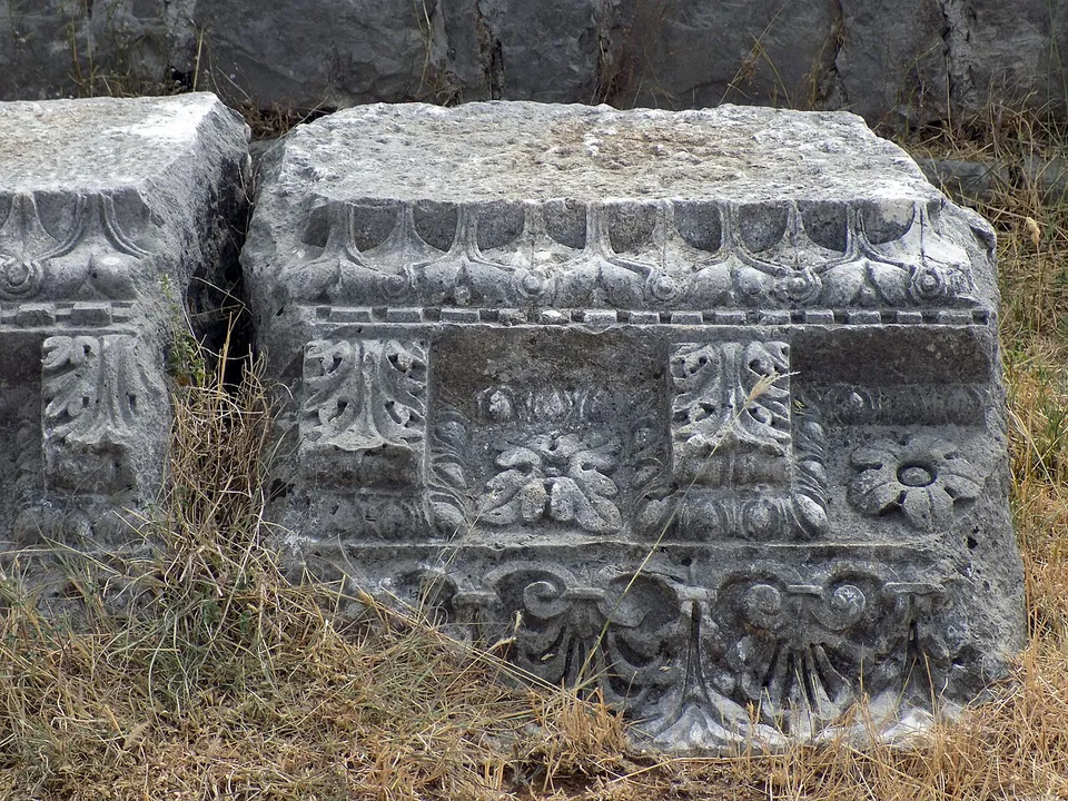


Doclea was the most important Roman town in what is now Montenegro (hr and sr.wikipedia), the centre of the Illyrian Docleatae and later the capital of the late Roman province of Praevalitana. Its ruins lie on an open plateau at the meeting of the Zeta and Morača rivers, about 3 km north of Podgorica: foundations, fallen columns and carved stone scattered across the fields.
What is there today
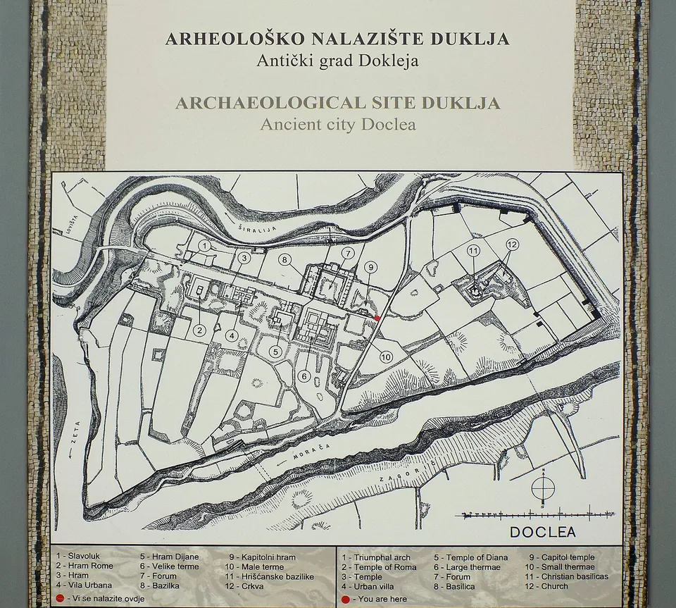
The walled town was a long, irregular polygon protected by rivers on three sides, with walls 2 to 2.3 m thick, strongest on the east, and remains of towers still visible on the north side (sr.wikipedia). The plan board at the site marks a triumphal arch, temples of Roma and of Diana, an urban villa, the forum, a basilica, large and small baths, the Capitoline temple, early Christian basilicas and a church (the information board). The main street, with its triumphal arch, ran north-west to south-east; traces of mosaic floors were found in the basilica (sr.wikipedia). On the ground today it is a field of wall footings, column drums and carved blocks, with some walls standing a few metres high (the photographs).
Is it worth the trip?
If you are in Podgorica, yes — Italian and Serbian Wikipedia count it among the most important archaeological sites in Montenegro, and it is only a few kilometres out of town. But it is an open field of ruins rather than a presented park, with little shade and few standing walls, and no official source says when it is open or whether there is a fee. Go with low expectations of facilities and a good imagination.
Getting there
Doclea is about 3 km north of Podgorica, on the plateau where the Zeta flows into the Morača (en.wikipedia; sr.wikipedia). A bus stop is mapped about 100 m from the centre of the site (OpenStreetMap). No operator publishes opening hours or an admission price.
Visiting details
- Tickets
- Unknown
Before you go
- No operator publishes opening hours or a fee for the site, and no official visitor information could be found. Information boards on site describe the main buildings.
- A bus stop is mapped about 100 m from the centre of the site (OpenStreetMap); Podgorica is about 3 km away.
History
The name is linked to the Docleatae, an Illyrian people; the town was their largest settlement. It became a municipium under Claudius according to English Wikipedia (under the Flavians, from 69, according to Croatian and Serbian Wikipedia) and had between 8,000 and 10,000 inhabitants; Pliny the Elder praised its cheese (en.wikipedia). A road from Scodra to Narona passed nearby, and an aqueduct brought water from the Cijevna (sr.wikipedia). When Diocletian split Praevalitana from Dalmatia, Doclea became its capital (en.wikipedia). The Capitoline temple was ruined and abandoned in the first half of the 4th century (the information board). Around 400 the town became a bishopric. The Visigoths attacked it early in the 5th century, and a severe earthquake destroyed it in 518 (en.wikipedia). The Ottomans later took stone from its ruins to build Podgorica, and its first excavations, in the 19th century, were unprofessional (sr.wikipedia).
More photographs

Sources
Every fact on this page comes from the records below, each used under the licence noted.
| Source | Licence |
|---|---|
| Pleiades 481808 | CC BY |
| Wikidata Q252273 | CC0 |
| OpenStreetMap way/961707114 | ODbL |
| Wikipedia (en) — Doclea (Illyria) | CC BY-SA 4.0 |
| Wikipedia (sr) — Доклеја | CC BY-SA 4.0 |
| Wikipedia (hr) — Duklja (grad) | CC BY-SA 4.0 |
| Commons — Ancient city Doclea, information board 01 (the site plan) | licence not recorded |
| Commons — Ancient city Doclea, information board 03 (Capitol temple) | licence not recorded |
